Only 2,016 more to go...
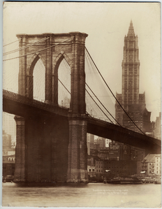
Looking towards Brooklyn from the East River
Spans - Manhattan-Brooklyn, East River
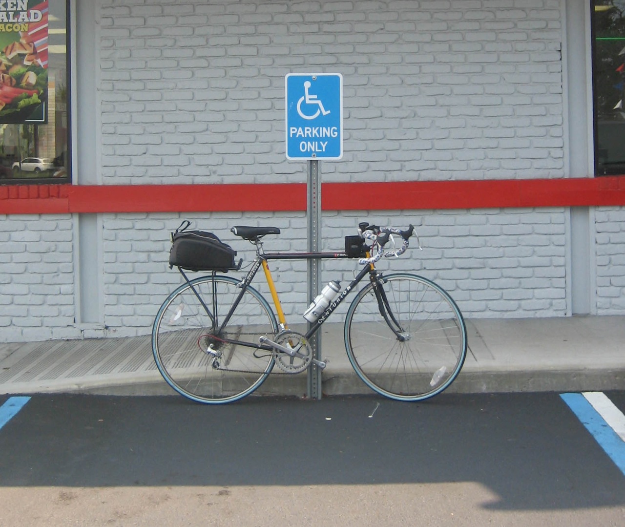
Delancey Street, LES to Broadway, Williamsburg Brooklyn.
Construction on the bridge began in 1896, and the bridge opened on December 19, 1903. Leffert L. Buck was chief engineer and Henry Hornbostel was architect. It was the second bridge to span the East River in NYC and at the time it was constructed, it set the record for the longest suspension bridge span on Earth which it took from it's neighbor, the Brooklyn Bridge, which had held the title for 17 years.
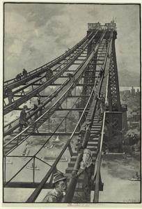
Wrapping Cables on the Williamsburg Bridge - From the NYPL Collection
"It is an unconventional structure, as suspension bridges go; though the main span hangs from cables in the usual manner, the side spans leading to the approaches are cantilevered, drawing no support from the cables above. The main span of the bridge is 1600 feet (488 m) long. The entire bridge is 7308 feet (2227 m) long between cable anchor terminals, and the deck is 118 feet (36 m) wide. The height at the center of the bridge is 135 feet (41 m) and each tower is 335 feet (102 m); these measurements taken from the river's surface at high water mark.
This bridge and the Manhattan Bridge are the only suspension bridges in New York City that still carry both automobile and rail traffic. In addition to this two-track rail line, connecting the New York City Subway's BMT Nassau Street Line and BMT Jamaica Line, there were once two sets of trolley tracks."
wikipedia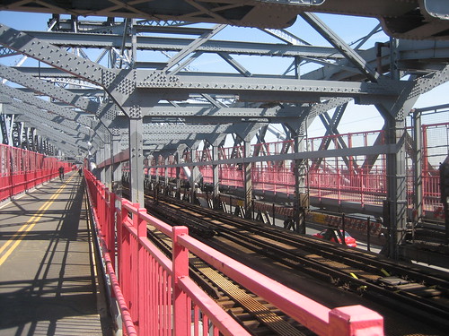
"For a brief period, the Long Island Rail Road (LIRR) ran passenger service along an elevated extension across the Williamsburg Bridge into Manhattan. The LIRR spur split from the existing Atlantic Avenue line northwest onto the Broadway elevated line (today's J, M and Z subway lines), crossed the Williamsburg Bridge, and continued south to Chambers Street.
The bridge not only served the traffic needs of a growing population, but also greatly affected migration patterns of ethnic groups. Before the bridge opened, first- and second-generation Irish and German settlers (who called the enclave "Kleine Deutschland") lived in the Williamsburg section of Brooklyn. When it opened, an influx of Jewish settlers from the overcrowded Lower East Side crossed the "Jews' Bridge" into Williamsburg. In turn, long-time residents moved out to Queens.
As early as 1964, The New York World-Telegram and Sun reported that the bridge had fallen in such a state of disrepair that rust rained down on pedestrians. The only fresh paint was the graffiti scrawled in by vandals. During the 1970's, the pedestrian walkways were closed after a maintenance worker was mugged while doing his job."
nyc roads.com
In the 1980's, the Bridge was in terrible condition after years of neglect and the City's near bankruptcy during the 1970's. It was closed completely for emergency repair work and for many years following was under constant renovation which impacted traffic in one direction or the other. Trains were re-routed and followed a strict speed limit when crossing the bridge. In 1999 service halted entirely to allow repairs on the center lanes of the bridge which carry train traffic.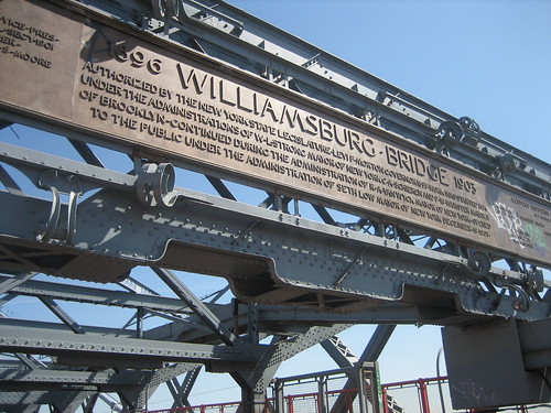
"The Williamsburg Bridge is one of the major crossings of the East River, carrying approximately 140,000 motorists, 92,000 subway/bus riders, 600 bikers and 500 pedestrians between the boroughs of Manhattan and Brooklyn and serving some of the busiest arteries in New York City."
NYCDOT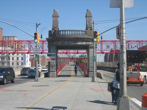
View of the Pedestrian and Bike Pathway Entrance on Delancey Street in Manhattan.
"The new footpath/bikeway has one common access point for pedestrians and cyclists in Manhattan at Clinton Street, which leads to a crossover before the main span of the bridge to enable people to access either the north or south paths. The north path is open to both pedestrians and bicyclists and leads to an access point at Washington Park in Brooklyn. The south path is dedicated to pedestrians an leads to an access point at Bedford Avenue. Completion of the new north walkway also means that, for the first time ever, the bridge is accessible to wheelchair users and meets the requirements of the Americans with Disabilities Act."
NYCDOT
One of my favorite little NY hidden gems is the fact that the pedestrian and bike paths end at Roebling Street on the Brooklyn side. That would be the street named after John A. Roebling, civil engineer and designer of the Brooklyn Bridge, which the Williamsburg Bridge superseded as the world's longest suspension bridge of it's time.
Type of bridge: Suspension
Construction started: November 7, 1896
Opened to traffic: December 19, 1903
Length of main span: 1,600 feet
Length of side spans: 300 feet
Length, anchorage to anchorage: 2,200 feet
Total length of bridge and approaches: 7,308 feet
Number of traffic lanes: 8 lanes
Number of subway tracks: 2 tracks
Height of towers above mean high water: 310 feet
Clearance at center above mean high water: 135 feet
Number of cables: 4 cables
Length of each of four cables: 2,985 feet
Diameter of each cable: 18¾ inches
Total length of wires: 17,500 miles
Weight of cables and suspenders: 4,344 tons
Structural material: Steel
Tower material: Steel
Deck material: Steel
Cost of original structure: $24,200,000
Bridge statistics from nyc roads.com
View Larger Map
Friday, April 11, 2008
The Williamsburg Bridge

Saturday, November 17, 2007
The Manhattan Bridge - Update
Oooh - Sexy!
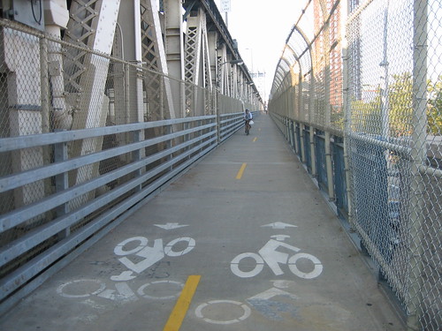
Yes, It's the bicycle specific, newly opened, bike lane on the Manhattan Bridge.
Check it out. Bike icons in both lanes.
Of course, I did see about 5 people on foot on the North Path, but who cares.
The approach on both sides is suicidal and takes you through some of the worst streets to cycle on, but it's so nice to ride across the river without fear of hitting or being hit by random tourists, kids, sightseers or joggers on the Brooklyn Bridge Footpath.
On the Manhattan side, the bike path entrance is at Chrystie Street on the left hand (North) side when facing the bridge from Canal Street.
The Brooklyn entrance to the path is a lovely new ramp at Jay and Sands Streets.
The approach to this is also crazy if you aren't used to riding in traffic - and hard to find if you don't know exactly where it is.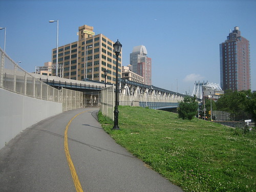
The stairs to the pedestrian path are on the Jay Street side and the ramp is on the Sands Street side.
The intersection of Jay and Sands is right in the middle of the traffic pattern leading from the BQE to both the Brooklyn and Manhattan Bridges, so you need to be alert, but if you are coming from Downtown Brooklyn the Adams Street approach (AKA Brooklyn Bridge Blvd) is completely empty of car traffic.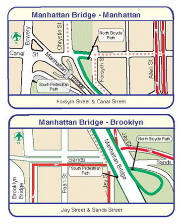
Sunday, November 4, 2007
The George Washington Bridge
Only 2,019 more to go...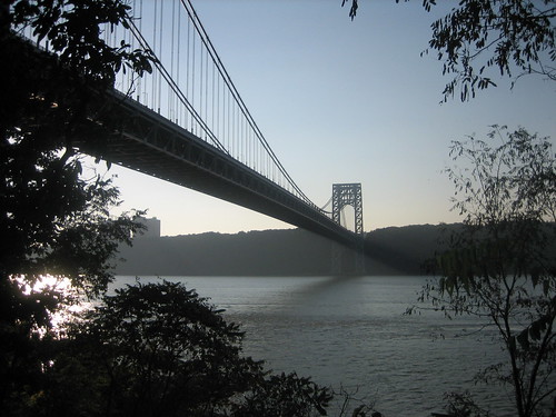
The George Washington Bridge seen from Washington Heights, looking across the Hudson River to the Englewood Cliffs.
Spans - New York-New Jersey, The Hudson River.
The George Washington Bridge is a toll suspension bridge spanning the Hudson River, connecting the Washington Heights neighborhood in the borough of Manhattan in New York City to Fort Lee in New Jersey by means of Interstate 95, U.S. Route 1/9. U.S. Route 46, which is entirely in New Jersey, ends halfway across the bridge at the state border. The GW is considered one of the world's busiest bridges in terms of vehicle traffic; In 2004, the bridge carried 108,404,000 vehicles, with current estimates of nearly 300,000 vehicles daily.
When it opened, the bridge had the longest main span in the world; at 1,067 m (3,500 ft), it nearly doubled the previous record of 564 m (1,850 ft), which had been held by the Ambassador Bridge.
The GW span is currently the fourth largest suspension bridge in the United States.
The bridge contains two levels, an upper level with four lanes in each direction and a lower level with three lanes in each direction, for a total of 14 lanes of travel. Additionally, the bridge houses a path on each side of the bridge for pedestrian traffic.
Groundbreaking for the new bridge began in October 1927. Its chief engineer was Othmar Ammann, with Cass Gilbert as architect. The bridge was dedicated on October 24, 1931, and opened to traffic the following day. Initially named the "Hudson River Bridge," the bridge is named in honor of George Washington, the first President of the United States. The Bridge is near the sites of Fort Washington (on the New York side) and Fort Lee (in New Jersey), which were fortified positions used by General Washington and his American forces in his unsuccessful attempt to deter the British occupation of New York City in 1776 during the American Revolutionary War.
Bridge facts from the wikipedia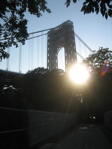
Modernist, Le Corbusier, said of the structure, "The George Washington Bridge over the Hudson is the most beautiful bridge in the world. Made of cables and steel beams, it gleams in the sky like a reversed arch. It is blessed. It is the only seat of grace in the disordered city. It is painted an aluminum color and, between water and sky, you see nothing but the bent cord supported by two steel towers. When your car moves up the ramp the two towers rise so high that it brings you happiness; their structure is so pure, so resolute, so regular that here, finally, steel architecture seems to laugh. The car reaches an unexpectedly wide apron; the second tower is very far away; innumerable vertical cables, gleaming against the sky, are suspended from the magisterial curve which swings down and then up. The rose-colored towers of New York appear, a vision whose harshness is mitigated by distance." (When the Cathedrals were White", 1947.)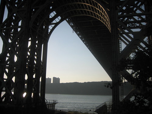
The bicycle and pedestrian pathway is accessible from 178th street, though the entrance to the ramp is so obscurely hidden that many people wander in circles, lost in the tangle of on-ramps and one-way streets.
The ramp itself is acutely curved and barely wide enough for two people, much less two cyclists. Once on the bridge, the pathway is fairly tight in places, narrowing through the towers into single lane, blind turns.
The path can be harrowing in high winds.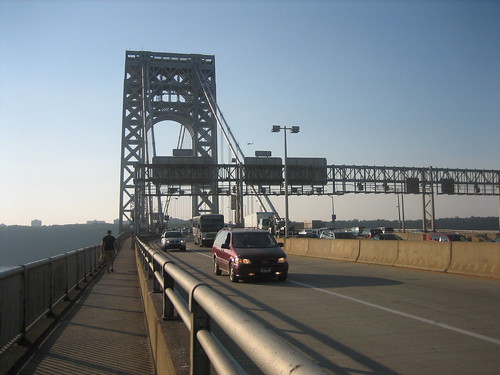
The view from the center of the span is one of the most spectacular in the world.
Commanding a view of the lower Hudson, Manhattan, and the Palisades, it rewards those hardy souls who make the trip.
The bridge is a common starting place for cyclists who make their way up the NJ side of the Hudson for training rides.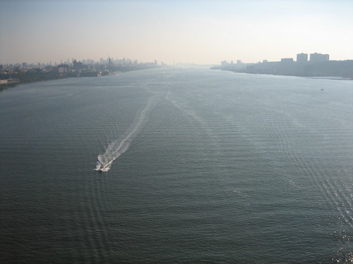
Looking down and to the left, the 'Little Red Lighthouse' that used to guard ships from running aground on the rocky point is still holding vigil - although now dwarfed by the span above it.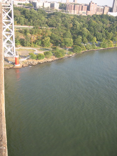
Type of bridge: Suspension
Construction started: October 21, 1927
Opened to traffic (upper deck): October 25, 1931
Opened to traffic (lower deck): August 29, 1962
Length of main span: 3,500 feet
Length, anchorage to anchorage: 4,760 feet
Width of bridge: 119 feet
Number of traffic lanes: 14 lanes (8 upper, 6 lower)
Height of tower above mean high water: 604 feet
Clearance at mid-span above mean high water: 213 feet
Cost of original structure: $59,000,000
Bridge statistics from nycroads.com
View Larger Map
Tuesday, October 2, 2007
The Manhattan Bridge
Only 2,020 more to go...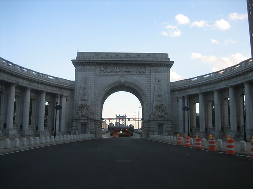
The Upper Deck Approach from the Manhattan side.
Spans - Manhattan-Brooklyn, East River
Canal Street, Chinatown to Flatbush Avenue, Downtown Brooklyn.
The Manhattan Bridge was the last of the classic three East River Crossings to be completed. It opened to traffic on New Year's Eve of 1909, and has been plagued by structural issues almost from day one.
When fully utilized, the bridge has the capacity to carry four lanes of traffic on its upper level, three lanes of reversing traffic on its lower level, four subway tracks and two pedestrian pathways, one of which was earmarked as a bicycle only route. 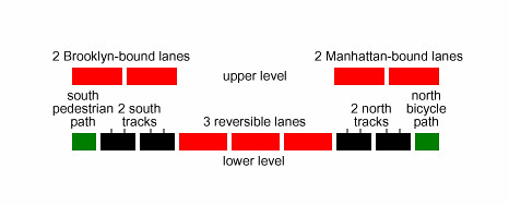
I've never actually seen this, because the bridge has been under continuous renovation since before I can remember.
(cross section taken from the Wikipedia entry for the Manhattan Bridge)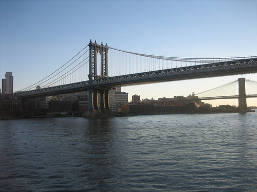
Apparently, the mysterious northern bike path is now open.
Important Notice
New York City Department of Transportation Division of Bridges
Rehabilitation of the Manhattan Bridge
"On Monday, August 6, 2007, the New York City Department of Transportation Division of Bridges will reopen the north bikeway of the Manhattan Bridge. The north bikeway has been closed since October 2006 to complete various construction tasks in association with the rehabilitation of the lower roadway of the bridge as well as to ensure and maintain public safety during the rehabilitation. Once the bikeway reopens the south walkway will revert to pedestrian use only."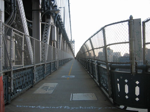
This is the South Walkway. (with a bicyclist in the distance)
Type of bridge: Suspension
Opened to traffic: December 31, 1909
Length of main span: 1,470 feet
Length of side spans: 725 feet
Length, anchorage to anchorage: 2,920 feet
Total length of bridge and approaches: 6,855 feet
Number of decks: 2 decks
Number of traffic lanes: 7 lanes (4 upper, 3 lower)
Number of subway tracks: 4 tracks
Height of towers above mean high water: 322 feet
Clearance at center above mean high water: 135 feet
Number of cables:
Diameter of each of four cables:
Length of each of four cables:
Structural material:
Tower material:
Deck material:
Cost of original structure: $31,000,000
Bridge statistics from nyc roads.com
View Larger Map
Thursday, September 27, 2007
The Triborough Bridge
Only 2,021 more to go...
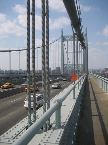
View of the pedestrian path on the East River section crossing from Astoria Queens to Randall's Island.
Spans Manhattan-Bronx-Queens, crossing Hell Gate (East River), The Harlem River, and the Bronx Kill.
The Triborough Bridge is a complex of three bridges connecting the three New York City boroughs of the Bronx, Manhattan, and Queens. The bridge uses what were originally two separate islands, Ward's Island and Randall's Island to support the center of the span.
The Robert Moses Building is the headquarters of M.T.A. Bridges and Tunnels, the successor to the old Triborough Bridge Authority. Robert Moses, the ultimate modern urban planner, kept his office at the center of his empire - on Randall's Island at the base of his biggest moneymaking bridge. Both the building and his office have been renovated over the years and no longer reflect the omnipotence of Moses at his peak.
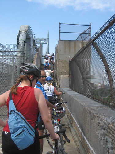
The Triborough does have a pedestrian path. It is mostly used by bicyclists who are legally required to dismount as they cross. Very few do so - until they run into one of the three staircases on the span. BEWARE.
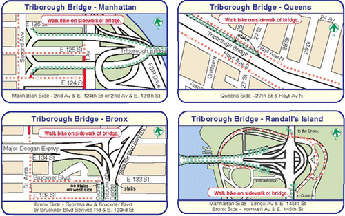
For those of you who have never crossed the Triboro by bike or foot, it can be very confusing. The DOT provides this map, but I get confused all the time, so here's a simple explanation.
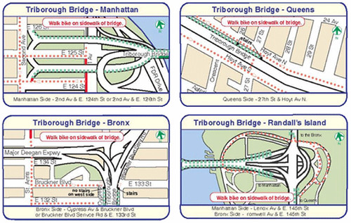
There is no direct route for cyclists and pedestrians from Queens to Manhattan or the Bronx. Instead of following the traffic, the path drops you on Randall's Island from all directions.
You need to cross the island and find the correct span for the borough you are going to, making the bridge a two-step process.
I haven't actually taken the Manhattan entrance this year, so I can't vouch for it, but if the ramps are open, they're at 124/126th and Second Avenue. If not, the stairs are at 124/126th and First Avenue.
Alternately, there's the Ward's Island Bridge at 103rd Street and the FDR, which is for bicyclists and pedestrians only. Ward's Island connects to Randall's Island.
The Queens entrance is the stairs at 27th and Hoyt.
The Bronx entrance is the ramp structure at 133rd and Cypress.
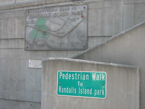
Here's a question that I never thought I'd ask, but in the context of this blog is sort of important. Is this one bridge or five?
Construction started: October 25, 1929
Opened to traffic: July 11, 1936
Total length of approaches (Manhattan-Queens-Bronx): 13,820 feet
Cost of original structure: $60,300,000
EAST RIVER SUSPENSION BRIDGE
Length of main span: 1,380 feet
Length of each side span: 700 feet
Length, anchorage to anchorage: 2,780 feet
Height of towers above mean high water: 315 feet
Clearance at center above mean high water: 143 feet
HARLEM RIVER LIFT BRIDGE
Length of main lift-truss span: 310 feet
Length of each side truss span: 230 feet
Length, anchorage to anchorage: 770 feet
Height of towers: 210 feet
Clearance of lift span above mean high water: 55 feet
Clearance of lift span in raised position: 135 feet
BRONX KILLS CROSSING
Length of main truss span: 383 feet
Length of approach truss span: 1,217 feet
Length, anchorage to anchorage: 1,600 feet
Clearance of truss span above mean high water: 55 feet
WARD'S ISLAND VIADUCT
Structural steel used: 29,500 tons
Reinforcing steel used: 5,500 tons
RANDALL'S ISLAND INTERCHANGE
Reinforcing steel used: 9,500 tons
Concrete used in roadway and piers: 111,200 cubic yards
Bridge Statistics from nycroads.com
View Larger Map
Tuesday, September 25, 2007
The Verrazano - Narrows Bridge
Only 2,022 more to go...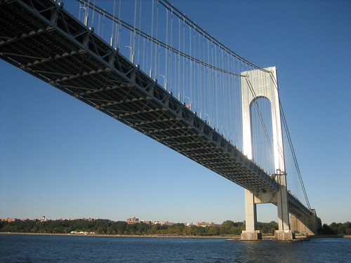
Spans - Brooklyn-Staten Island, The Narrows, New York Harbor.
According to the MTA, the Verrazano-Narrows Bridge was the world's longest suspension span when it opened in 1964.
"Its monumental 693 foot high towers are 1 5/8 inches farther apart at their tops than at their bases because the 4,260 foot distance between them made it necessary to compensate for the earth's curvature. Each tower weighs 27,000 tons and is held together with three million rivets and one million bolts. Seasonal contractions and expansions of the steel cables cause the double-decked roadway to be 12 feet lower in the summer than in the winter." (MTA website)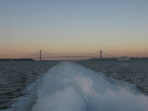
The Bridge at dawn as seen from the approach to New York Harbor
The bridge was designed by Othmar Ammann, who had also designed many of the most beautiful and iconic bridges in New York City, including the George Washington Bridge, the Bayonne Bridge, the Bronx Whitestone Bridge, the Triborough Bridge, Throgs Neck Bridge and the lovely, Hell Gate Bridge (AKA, The New York Connecting Railroad Bridge).
The dramatic silhouette of the span may be best known as the starting point for the annual NYC Marathon, but it is also featured in many films set in NYC. My personal favorite is from Saturday Night Fever when Tony Manero (John Travolta) and his Bay Ridge friends all get wasted and climb all over the cables.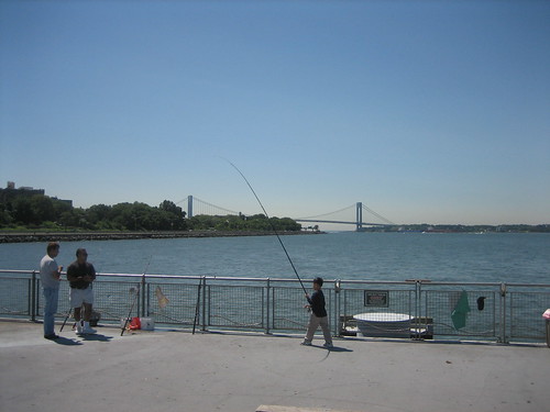
View from the 69th Street Pier, looking South to the mouth of the harbor.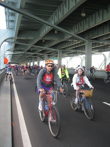
Crossing the span during the 2007, NYC 5Boro Bicycle Tour, one of the few opportunities for non-motorists to cross the bridge which has no provisions for pedestrians or bicyclists.
Type of bridge: Suspension
Construction started: August 13, 1959
Opened to traffic (upper deck): November 21, 1964
Opened to traffic (lower deck): June 28, 1969
Length of main span: 4,260 feet
Length of each side span: 1,215 feet
Length, anchorage to anchorage: 6,690 feet
Total length of bridge and approaches: 13,700 feet
Width of bridge: 103 feet
Number of decks: 2 decks
Number of traffic lanes: 12 lanes (6 upper, 6 lower)
Height of towers above mean high water: 693 feet
Clearance at center above mean high water: 228 feet
Deepest foundation below mean high water: 170 feet
Cost of original structure: $320,126,000
Bridge statistics from nycroads.com
View Larger Map
Wednesday, September 19, 2007
The Brooklyn Bridge
2,026 to go...
No other bridge could be Number 1 on the list.
Span - Manhattan to Brooklyn across the East River
The Brooklyn Bridge, one of New York City’s most celebrated architectural wonders and arguably the most influential bridge in American history, was completed in 1883. Designed by John Augustus Roebling and completed by his son Washington Roebling, the Brooklyn Bridge was, at the time of its completion, the longest suspension bridge in the world, with a main span of 1595.5 feet.
It received landmark status in 1964 and is the oldest bridge that is open to passengers or vehicles.
The Brooklyn Bridge had 137,563 vehicle crossings on an average weekday in 2004.
Quoted from: Transportation Alternatives, The DOT, and
the Wikipedia entry for The Brooklyn Bridge
Pedestrian and Bicycle access to the Brooklyn Bridge -
Access to the bridge has improved markedly over the last few years.
The city recently added much needed signs and lighting to the Cadman Plaza Stairway entrance that is heavily used by tourists and pedestrians.
Last year, they added a two-way protected bike lane on Tillary Street to facilitate access to the bridge from the Downtown and Heights neighborhoods.
The Adams Street bike path is still basically unusable due to the fact that the Marriott allows livery cab drivers to park all along the length in front of the hotel.
The Manhattan entrance is easy to find, but hard to legally ride to on a bicycle. The safest thing to do is dismount and walk from the corner of Centre and Chambers Streets to the pedestrian entrance, due to traffic and crowds, but very few cyclists do this.
The pathway across the bridge is separated into two distinct lanes; the southern lane is for pedestrians, the northern lane for cyclists. These are clearly marked with icons, but are largely ignored by tourists who don't know any better.
Manhattan entrance: Park Row and Centre Street, across from City Hall Park.
Brooklyn entrance: Stairs under the overpass at Cadman Plaza East and Prospect Streets, or ramp to Tillary and Adams Streets.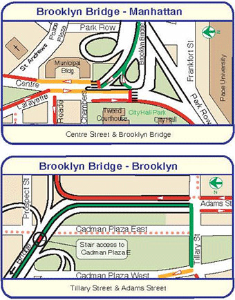
Cyclists at dawn crossing the Brooklyn Bridge during the 2007 NYC Century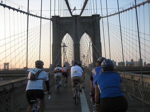
Sunrise over the Manhattan Bridge from the pedestrian walkway of the Brooklyn Bridge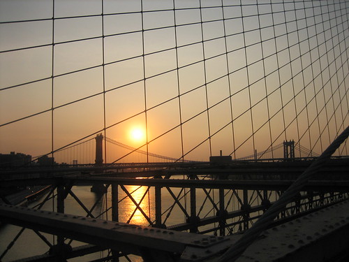
Type of bridge:Suspension
Construction started:January 3, 1870
Opened to traffic:May 24, 1883
Length of main span:1,595 feet, 6 inches
Length of side spans:930 feet
Length, anchorage to anchorage:3,455 feet, 6 inches
Total length of bridge and approaches:6,016 feet
Width of bridge:85 feet
Number of traffic lanes:6 lanes
Number of cables:4 cables
Height of towers above mean high water:276 feet, 6 inches
Clearance at center above mean high water:135 feet
Length of each of four cables:3,578 feet, 6 inches
Diameter of each cable:15¾ inches
Number of wires in each cable:5,434 wires
Total length of wires:14,060 miles
Total masonry in towers:85,159 cubic yards
Weight of suspended structure:6,620 tons
Total weight of bridge:14,680 tons
Cost of original structure:$15,100,000
Bridge facts from NYCRoads.com
View Larger Map